Of Gravel Mine Area (CGP) 1993 -- NM Abandoned Mine Land Bureau Aerial

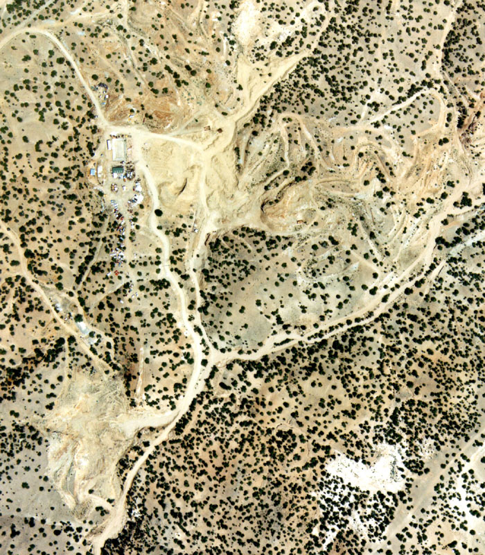
Taken May 25, 1993, between 1pm and 2pm, State of New Mexico Abandoned Mine Land Bureau. The 2 historic sites, Bethsheba in the upper right, Mina del Tiro, less obvious.

Compare 1978 with 1993 with 1996 with 1997 with 1998 with 1999 with 2000


Top page 1 -- Contents
Aerial 1993
Satellite 1996, NASA, Oct. 6, 1996
To aerials 1997
To close-up, 1997, SE
To close-up, 1997, SW
To close-up of pit area, 1997
Two other views, 1997
To aerials 1998, 1&2
To aerials 1998 3&4
To aerials 1998 5&6
To aerial 1999 & close-up
Post Oxymin Image (after 1978)
Aerials of "Becho" Area, 1993-9