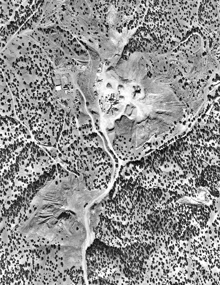
"Uncropped" photo of CGP taken by NMDOT, Nov. 2, 1999

--taken from aprox. 13,500 feet above landscape--

     "The applicant has clearly mined outside the [once permitted] 3 acre area ... without ... County approval, and the applicant has not provided reclamation of any kind." --From, Santa Fe County Land Use Administrator to CGP, July 6, 1999.

Compare 1978 with 1993 with 1996 with 1997 with 1998 with 1999 with 2000

To Close-up of east side where the hill of the valley was but no longer exists.

--------------------

Top page 1 -- Contents
Aerial 1993
Satellite 1996, NASA, Oct. 6, 1996
To aerials 1997
To close-up, 1997, SE
To close-up, 1997, SW
To close-up of pit area, 1997
Two other views, 1997
To aerials 1998, 1&2
To aerials 1998 3&4
To aerials 1998 5&6
To aerial 1999 & close-up
Post Oxymin Image (after 1978)
Aerials of "Becho" Area, 1993-9